
Wilsonville Block Sources and Neighbors
The best official picture of a Wilsonville block is a chain of parcel sources. Locate the subject address in WilsonvilleMaps, identify the county for that parcel and adjoining lots, then use the appropriate county map or assessment channel. Each source establishes a limited fact: parcel placement, tax or deed context, city document history, planning context, or a legal voter-record route. None is a universal list of people living nearby.
| Block source | What it shows about a block | Access and boundary |
|---|---|---|
| WilsonvilleMaps | Parcel placement, city map themes, available building documents | Free map; primary parcel address and tax-lot syntax; no universal person list. |
| Clackamas CMap | Adjacent parcels, aerial context, jurisdiction, services, and hazards | Free; boundaries are not survey quality; owner names are not published online. |
| Washington InterMap | Washington-side parcel location and assessment report path | Free locator; owner information follows county channels. |
| County recording | Prior parties, legal descriptions, plats, and deed relationships | Use the correct county office; online coverage must be confirmed. |
| City planning plans | Development history and map context | Public plans, not a membership directory. |
| Voter records | Lawful official election-record process | My Vote is not a block tool; protected fields are excluded. |
A tax mailing contact or recorded party may have a relationship to a parcel without living there. Treat names as record roles until another official source supports a narrower conclusion.
Map a Wilsonville Neighbor Block
The adjacent-parcel method is the useful way to examine a small area. It follows the map outward from one confirmed address and keeps each parcel’s county attached to the notes. Wilsonville crosses the Clackamas and Washington County line, so adjoining land can require different official routes. Map imagery helps navigate but neither a fence nor an aerial view determines a legal boundary.
- Find the subject address in WilsonvilleMaps and select the matching primary parcel.
- Record its tax lot and identify the county before opening another public system.
- Browse touching tax-lot polygons, recording each adjoining parcel and its county rather than assuming one county for the whole block.
- Use CMap for a Clackamas parcel or InterMap for a Washington parcel to view documented property context.
- Use the county’s official owner-information channel only when a property-record question requires it, then keep tax-contact data separate from the situs address.
For a complete named-street property trail, the Wilsonville street directory follows the recorder and parcel workflow beyond the immediate block. The neighbors method stays focused on adjoining land and community context.
Note: Record tax lots and counties first, because nearby parcels can sit under separate offices even with the same mailing city.
Wilsonville Clackamas Block Records
On the Clackamas side, CMap accepts address, city, intersection, tax lot, and parcel-number searches. Its controls support zoom and aerial viewing. The County describes building information, value categories, jurisdiction, voting districts, service providers, natural hazards, surveys, and tax maps as map context. It does not publish property owner names online. Assessment & Taxation provides the documented official owner-information fallback at propertytaxinfo@clackamas.us or 503-655-8671.
The captured CMap parcel viewer shows the map controls used to move across a Clackamas block.
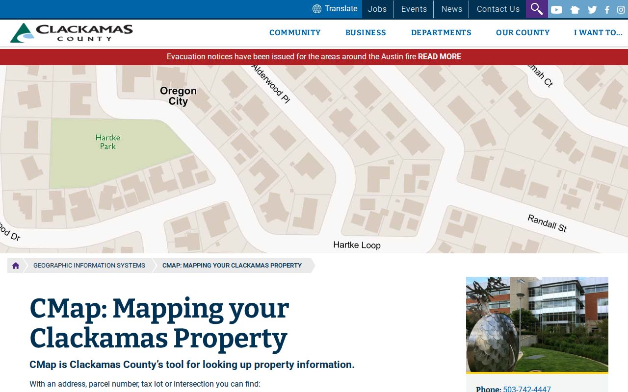
The viewer can establish map relationships and jurisdiction. The County’s non-survey warning means its display cannot decide where a legal property line lies.
Wilsonville Washington Parcel Records
For a Washington County-side parcel, InterMap locates a property by address, Tax Lot ID, or R number. At the map location, select Additional Information and then Assessment & Taxation Information. The County describes general property information, sales or deed information, assessed values, improvement information, and improvement details. This supplies property context for a specific lot, not proof of the people on it.
Washington County says owner names are available through lobby customer-service computers, phone at 503-846-8741, or e-mail, at 155 N First Street, Suite 130 in Hillsboro. Its ownership data are for property-tax purposes. Use the official county route where relevant and do not turn a tax mailing address into a claim that the recipient is a neighbor at the situs.
- Tax lot
- A parcel identifier used on tax maps and in land records.
- Situs address
- The physical location of the parcel, distinct from a correspondence address.
- Legal description
- The lot, block, plat, tax-lot, or other land description used in recording.
- Adjacent parcel
- A property touching or nearby on a map, not proof of a shared boundary or social relationship.
Wilsonville Neighbor Block Files
WilsonvilleMaps can add an address timeline to a block search. After selecting a parcel, scroll to Building Documents and open Public Building Documents. The released material may include permit history, inspection records, certificates of occupancy, construction plans, and water or sewer site-plan material. Residential construction plans began being scanned and digitally retained in 2015. An older structure may still have a permit record even when a plan is not available online.
The City’s official map search tips explain that address matching uses the primary parcel address. Entering only a street number can produce suggested addresses; suites, units, and apartments are not the address-search key.
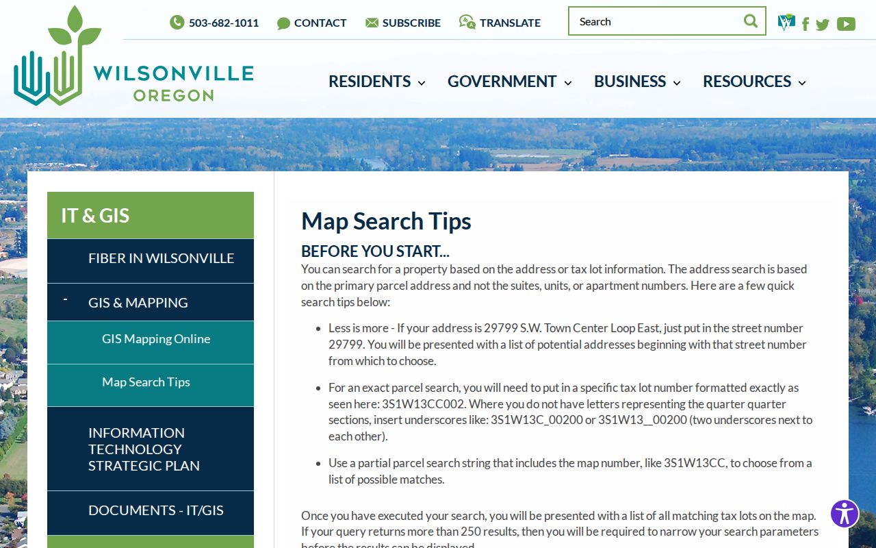
Missing online documents can be requested from the City with an address, tax lot, project name, department, record type, and date range. A permit applicant or contractor is a document participant, not a verified nearby resident.
Wilsonville Neighbor Association Leads
The City’s published homeowner-association inventory is a useful geographic lead for a block, but it is not a membership directory. The inventory includes associations across Wilsonville and directs people seeking association contact information to Oregon Secretary of State Corporation Division nonprofit databases. It does not release individual member or resident contacts. That limitation is important when neighborhood names are being used to understand an area rather than identify people.
| Association lead | City inventory status | Proper use |
|---|---|---|
| Arbor Crossing, Arbor Lake, and Arbor Villebois | Listed in the City inventory | Association and geographic research lead |
| Charbonneau and Renaissance Boat Club | Listed in the City inventory | Area context, then use the SOS contact-research direction |
| Rivergreen and Daydream River Estates | Listed in the City inventory | Neighborhood terminology, not a resident roster |
| Villebois Village Center and Legend at Villebois | Listed in the City inventory | Association-name lead only |
| Wilsonville Meadows and Lakeside | Listed in the City inventory | Check official association-contact route if needed |
The captured Wilsonville HOA inventory is the documented source for these association names.
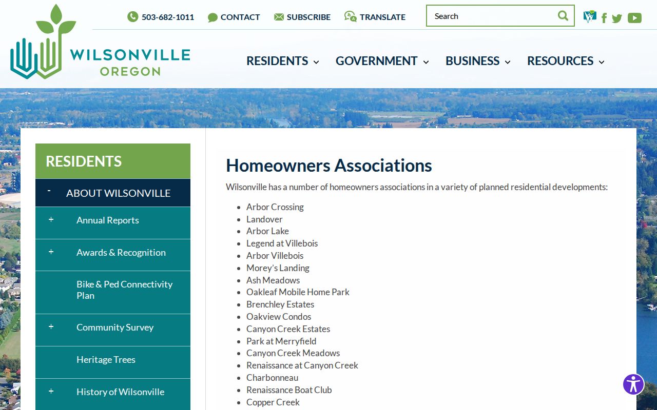
Association names can refine a planning or map question. They do not show a list of members, a block-watch roster, or household contact information.
Note: The City inventory supports association research, but it does not verify a person’s presence, membership, or contact details.
Wilsonville Neighbor Voter Limits
Oregon My Vote is an official self-service portal for a voter to view that voter’s own registration information. The inspected landing page does not document public street browsing or a block roster. A statewide electronic voter-list request goes through the Secretary of State, while smaller hard-copy, label, or non-electronic requests go to the affected county elections official. Because Wilsonville is in two counties, a citywide request can involve both county offices unless the state route provides the requested format.
ORS chapter 247 and confidentiality rules limit disclosure. Protected addresses and some voter information are excluded, and participation information is not a ballot-choice record. Election records should not be used to profile a block or contact people there.
Note: A voter’s self-service view and a permitted voter-list request are different channels with different limits and uses.
Official Wilsonville Neighbor Tools
Official parcel sources state their coverage, record role, and access boundary. A commercial neighborhood-search category may present names near an address, but it does not replace a county’s tax-lot, recording, or protected-record rules. When a precise property claim matters, prefer the source that holds the record and verify its county before relying on it.
| Official route | Commercial neighborhood-search category | Practical difference |
|---|---|---|
| County map, assessment, or recording office | Compiled address-oriented listings | Official route identifies record type and documented limits; compiled data can mix dates and roles. |
| WilsonvilleMaps building-document route | General address summaries | City files can show available document activity; a summary does not establish residency. |
| City HOA inventory | Purported community lists | City inventory gives association names, not members or personal contacts. |
Use the association inventory, parcel maps, and county contacts as narrow research tools. When the official channel withholds a field, respect the limit rather than substituting an unverified claim.
Wilsonville Neighbor Lookup Limits
A Wilsonville neighbor lookup can show parcel relationships and limited official property context. It cannot establish every person in a building. Renters, household members, protected-address participants, utility accounts, delivery information, and DMV personal data are not available through the documented block tools. A party on a deed or tax record may live elsewhere, and a map image may not show a legal boundary.
Oregon’s Safe at Home program can supply a substitute address for eligible participants, and Oregon public-record rules contain exemptions and correction paths. If a custodian does not release a field, the proper result is a narrower request or no result, not an inference about the block.